Google Earth on SLED 10: Google Earth the way it was meant to be
In an earlier post I unfairly trashed Google Earth. The problem, as I've just discovered, more than likely rests with my graphics hardware platform, not Google Earth. While I was working with SLED 10 this morning I pulled down another copy of Google Earth and installed it on SLED. When I started Google Earth it was silky smooth in its operations and highly responsive, just the opposite of my experience with Google Earth on my Ubuntu system. This is not a slam of Ubuntu, but a realization that maybe, just maybe, I need to upgrade the video card on that system (at the very least) if I want a good experience running applications like Google Earth. Conversely, I've come to develop an even greater appreciate of Ubuntu's performance on low-end graphics hardware.
I'm going to start these screen shots off with a view above the Earth zooming into the Kennedy Space Center, then a final shot showing a feature I find really useful, 3D buildings.
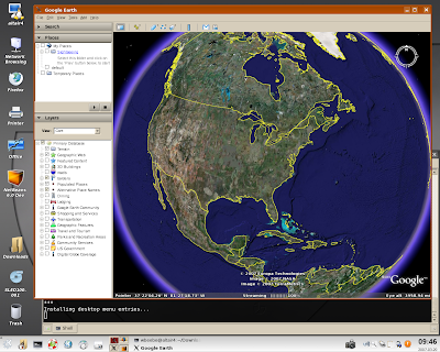 First we open up the application. The zoom into this magnification was smooth as silk as well as automatic. And this is where it stopped.
 It was then a matter of using the mouse's scroll wheel to zoom further into Florida. I used the left mouse button to grab and position the globe, and found my one annoyance; not only do you move the globe around, but you can also change the North orientation very easily. Perhaps a little too easily. It's not that big a deal as you can hover over the compass rose in the upper right and then re-orient north, but I wish I could just lock north as pointing straight up.
 I'm continuing to move towards my first destination. At every level the detail of the landscape was crisp and well-colored.
 Finally, I stop over pad 39B.
 In this image I wanted to test Google Earth's ability to find a location. I asked it to search for "bolsa avenue, huntington beach". It's a location I've traveled to on business in the past (hello, Paul). Sure enough, it went where I wanted it to go, in Huntington Beach, California. I zoomed in manually on my own until I was right above Boeing. I was over Nevada at the time, and when I started the search, Google Earth "flew" up, arched over the terrain, then smoothly dropped down over Bolsa Avenue. If you get a chance look at some of the videos at the Google Earth site showing this effect. It's like a digital magic carpet.
 The site of the former WTC. I turned on 3D buildings just to see what would happend over a big urban center like New York City. I personally like the effect. It helps you better understand the urban terrain you're viewing.
 And a perspective view of the site, looking roughly north-west, again with 3D Buildings enabled. It's an excellent feature in those urban areas that have many buildings mapped and in the terrain database.
Besides learning that I really need to upgrade my video card on rhea if I want to play with Google Earth at home, I also learned that Google Earth is quite the map application on Linux as well as Windows. I have a much better appreciation of the application, and feel it's on par with Nasa's World Wind application. The fact that Google Earth is now available for Linux and Macs is a big plus up over World Wind, which is currently available only for Windows. Google Earth is an impressive application, and Linux (with the right hardware :) is a great platform on which to run it.
Comments
Post a Comment
All comments are checked. Comment SPAM will be blocked and deleted.